
Air masses and fronts
One small step at a time. Ask for a clue whenever you need one.
Ask about your own question- Step 1
- Step 2
- Step 3
- New question
A cold, dry air mass from Canada meets a warm, moist air mass from the Gulf. Which air mass stays at the ground?
Common mix-up
In this example, a student wrote They mix in the middle, and the warm air stays at the ground..
A front is the boundary between two air masses, not a cloud wall. Denser cold air slides under warm air and lifts it.
Guided example. Your answers aren’t saved or sent.
See why this works
What happens when cold air meets warm air?
You said a front is a wall of dark cloud. A front is the moving boundary between two air masses; clouds and storms gather along it.
A front is the boundary between two air masses; the denser cold air wedges under the warm air and lifts it into clouds.
An air mass is a huge body of air, often thousands of kilometers wide, with similar temperature and moisture everywhere. It picks up those properties from the land or sea it sits over: a cold, dry air mass forms over frozen Canada, and a warm, humid one forms over the Gulf of Mexico. Air masses travel, slowly changing the weather of everywhere they cross.
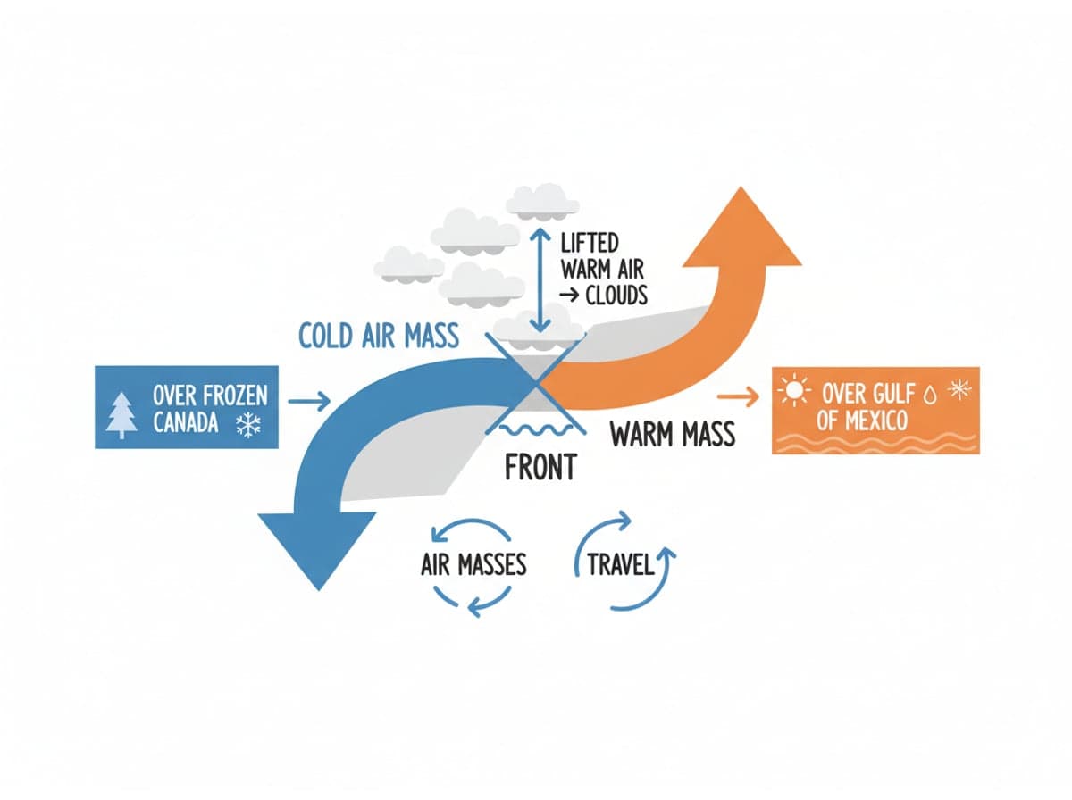
When two air masses meet, they do not mix like paint. They stay separate, and the boundary between them is a front. Forecasters draw fronts as lines on weather maps. Because the two sides differ in temperature and moisture, fronts are the storm factories of the middle latitudes: the atmosphere's strongest weather happens right along these edges. A line on the map is really a whole weather system in motion.
Why does warm air go up? Cold air is denser, so it slides under the warm air and lifts it. Rising air cools, its moisture condenses, and clouds form. Along a cold front, a bulging wedge of cold air pushes in quickly and shoves warm air up sharply. Towering clouds bring hard, short downpours and gusty winds, and cooler, clearer weather follows the front's passage.
A warm front is gentler. Warm air glides slowly up a retreating cold air mass over a long distance, so its clouds spread into grey sheets and the rain is steady and lighter. As the warm front passes, the air itself turns milder. Watch the sky and you can sometimes read the sequence overhead: high thin clouds first, then lower, darker layers, just before the front's rain arrives.
Keep this idea
A front is a boundary between air masses. Cold fronts slice in with hard rain, warm fronts glide over with steady rain, and density decides which air goes under.
The practice checks apply only to the displayed examples. Follow your teacher’s guidance for your own assignments.
Get help with your own questionA practice lesson each week.
A short practice lesson for your inbox. Free, with a one-click unsubscribe.